La Mata (Sur)
Valencian Community, Spain: Excellent water quality
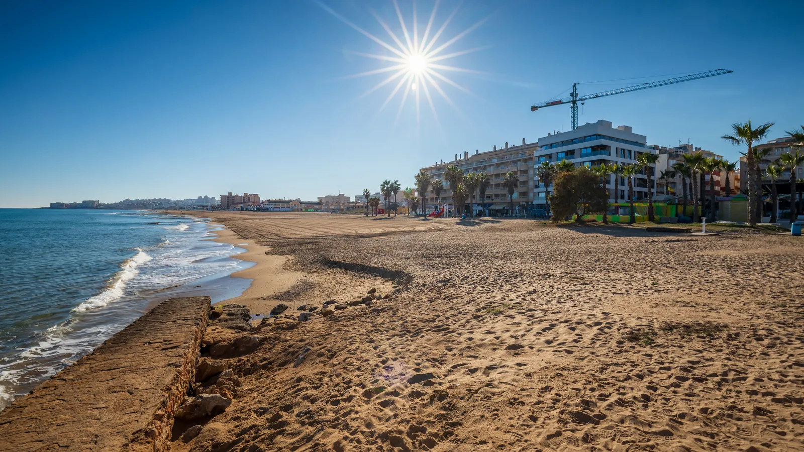
La Mata (Sur) is a beach on Spain's coastline, 5.97 km from Torrevieja. It holds the Blue Flag award, which means it meets strict standards for water quality, environmental management, and lifeguard services.
Quick Overview
Plan Your Visit to La Mata (Sur)
The key facts before you go
About the Beach
What is La Mata (Sur)?
La Mata (Sur) is a beach on Spain's coastline, 5.97 km from Torrevieja. It holds the Blue Flag award, which means it meets strict standards for water quality, environmental management, and lifeguard services.
The best months to visit are May, June, and September, when crowds are lighter. July and August draw the most visitors. January, February, March, and December are quieter months.
Check local water safety conditions before swimming. The Blue Flag is awarded annually by the Foundation for Environmental Education, so standards are regularly verified. The beach works well for families and swimmers looking for a safe, well-maintained spot.
It sits alongside Blue Flag beaches in Valencian Community, part of a broader network of Blue Flag certified beaches across Spain certified annually by the Foundation for Environmental Education.
Sunrise, Sunset & Beach Direction
La Mata (Sur) faces west toward Mediterranean Sea. The best light for photography and swimming is typically in May, June, September. Direct sun hours follow that facing.
Planning
When to Go: Month by Month
| Month | Air Temp | Water Temp | Crowds |
|---|---|---|---|
| Jan | 12°C | 12°C | Low |
| Feb | 12°C | 13°C | Low |
| Mar | 14°C | 15°C | Low |
| Apr | 17°C | 17°C | Med |
| May | 20°C | 18°C | Med |
| Jun | 24°C | 22°C | Med |
| Jul | 26°C | 25°C | High |
| Aug | 27°C | 25°C | High |
| Sep | 24°C | 23°C | Med |
| Oct | 20°C | 21°C | Low |
| Nov | 16°C | 16°C | Low |
| Dec | 12°C | 13°C | Low |
The best time to visit La Mata (Sur) is May, June, September. Air temperatures peak around 26.4°C in summer. Peak water temperature reaches 24.9°C in July.
How crowded does La Mata (Sur) get?Like most Blue Flag beaches in Spain, La Mata (Sur) sees its highest visitor numbers in July and August. The beach maintains a pleasant atmosphere even in peak season.
Is La Mata (Sur) open year-round?The beach itself is accessible year-round, though staffed facilities including lifeguards typically operate only during the official season (typically July–September). The Blue Flag is displayed during the certification period only.
The Water
Swimming and Beach Life at La Mata (Sur)
Is La Mata (Sur) safe to swim?La Mata (Sur) is Blue Flag certified, which requires meeting strict bathing water standards set by the EU Bathing Water Directive. Water quality is rated Excellent. The beach does not have lifeguards stationed on the beach. Swim with appropriate caution.
What is the water temperature at La Mata (Sur)?Peak water temperature at La Mata (Sur) reaches around 24.9°C in July, making it comfortable for swimming during the summer months. In winter (January), air temperatures average 11.7°C.
What is the beach like at La Mata (Sur)?La Mata (Sur) on the Valencian Community coast of Spain. The best months to visit are May, June, and September, when crowds are lighter. July and August draw the most visitors. January, February, March, and December are quieter months.
Does La Mata (Sur) have good facilities?As a Blue Flag certified beach, La Mata (Sur) meets the Foundation for Environmental Education's standards for facilities and services. Toilet facilities are on site. Parking is available nearby.
La Mata (Sur) sits on the Mediterranean Sea: explore all Blue Flag beaches on the Mediterranean.
Planning a trip to Spain? Blue Flag Beaches Spain 2026 , our editorial guide to certified beaches across the country.
Transport
Getting to La Mata (Sur)
How do I get to La Mata (Sur) by car?La Mata (Sur) is approximately 5.97 km from Torrevieja. Follow local road signs to the beach. Check Google Maps or a local map for the most current directions.
What is the nearest airport to La Mata (Sur)?The nearest airport is Alicante-Elche Airport (ALC), approximately 29.9 km away.
Can I get to La Mata (Sur) by public transport?Public transport options vary by season. Check local transport authority websites for current bus and train schedules connecting to Torrevieja. The nearest recorded bus stop is 178 m from the beach.
Nearby
Near La Mata (Sur)
Mapped toilets, bus stops, cafés, parking, and shops within about 500 m of La Mata (Sur). Distances are walking-line estimates from the beach pin.
Map loads when you ask. Tiles stay off the first paint.
Map: OpenStreetMap (ODbL)
Toilets near La Mata (Sur)
- Public toilets Public toilets 124 m
Bus near La Mata (Sur)
- Calle Mayor - Encarnación Puchol Bus stop 178 m
- Avda. Virgen del Carmen Bus stop 201 m
- Bus stop Bus stop 269 m
- Av. de los Daneses (Petanca) Bus stop 285 m
- Avda.del Mar Bus stop 316 m
Cafés near La Mata (Sur)
- La despensa Restaurant 72 m
- La Mar de Bien Restaurant 75 m
- lasfloresplaza Restaurant 83 m
- Mara Mar Restaurant 89 m
- Cover Ice cream 95 m
Parking near La Mata (Sur)
- Parking Parking 189 m
- Parking Parking 365 m
- Parking Parking 365 m
- Parking Parking 381 m
- Parking Parking 432 m
Supermarket near La Mata (Sur)
- Unide - Maxcoop Supermarket 116 m
- Supermarket Supermarket 187 m
Source: © OpenStreetMap contributors (ODbL). Names and positions come from mapped OSM features. Confirm on site.
Practical Details
Practical Information
| At the Beach | |
| Entry | Free: no charge to access the beach |
|---|---|
| Lifeguards | ✗ |
| Showers | ✗ |
| Toilets | ✓ Available during season |
| Official Season | May – October |
| Beach Type | Coastal beach |
| Parking | ✓ Available nearby (street-side parking) |
| Nearest supermarket | 120 m from the beach |
| Nearest bus stop | 178 m from the beach |
| Visiting Information | |
| GPS Coordinates | 38.0257°N, 0.6529°W |
| Water Quality | Excellent (EU Bathing Water Directive) |
| Blue Flag Operator | Foundation for Environmental Education (FEE), Spain |
Frequently Asked Questions
La Mata (Sur) FAQ
Is La Mata (Sur) suitable for children?
La Mata (Sur) has a child-friendly score of 3/10. Facilities include toilets and parking. It is Blue Flag certified in Spain.
Is La Mata (Sur) free to access?
Access to La Mata (Sur) is free. There are no entry fees to enter the beach. It is a Blue Flag certified beach in Valencian Community, Spain, recognised for meeting international standards for water quality and environmental management.
When is the best time to visit La Mata (Sur)?
The best time to visit La Mata (Sur) is May, June, September. The peak season typically runs High season: July, August, when weather conditions and facilities are at their best. Peak water temperature reaches around 24.9°C in July. Outside peak season, the beach is quieter but some facilities may be reduced.
What is the water quality at La Mata (Sur)?
La Mata (Sur) is Blue Flag certified, which requires meeting strict EU Bathing Water Directive standards. Water quality is rated Excellent. Blue Flag certification is awarded and reviewed annually by the Foundation for Environmental Education (FEE). Beaches must pass water quality tests throughout the season to retain their status.
How do I get to La Mata (Sur)?
La Mata (Sur) is located in Valencian Community, Spain. It is approximately 5.97 km from Torrevieja. The nearest airport is Alicante-Elche Airport (ALC), 29.9 km away. By car is the most flexible option. Check local transport authority websites for current bus and train schedules to the area.
Are there toilets near La Mata (Sur)?
Yes. OpenStreetMap maps toilets near La Mata (Sur), including 124 m away. Distances are walking-line estimates within about 500 m of the beach pin. Confirm opening hours on site; some facilities are seasonal. © OpenStreetMap contributors (ODbL).
Is there a bus near La Mata (Sur)?
Yes. OpenStreetMap maps a public-transport stop 178 m from La Mata (Sur) (Calle Mayor - Encarnación Puchol), plus 4 more within about 500 m. Check current timetables before you travel. © OpenStreetMap contributors (ODbL).
Are there cafés near La Mata (Sur)?
Yes. OpenStreetMap lists 5 cafés or restaurants near La Mata (Sur), including La despensa (72 m), La Mar de Bien (75 m), lasfloresplaza (83 m), and Mara Mar (89 m). Hours and seasonal opening are not verified here. Check on the day. © OpenStreetMap contributors (ODbL).
Is there parking near La Mata (Sur)?
Yes. OpenStreetMap maps parking 189 m from La Mata (Sur), with 5 lots or spaces inside about 500 m. Charges and time limits are not recorded here. © OpenStreetMap contributors (ODbL).
Is there a supermarket near La Mata (Sur)?
Yes. OpenStreetMap maps a supermarket 116 m from La Mata (Sur) (Unide - Maxcoop). Walking-line distance; confirm opening hours locally. © OpenStreetMap contributors (ODbL).
Explore More
Nearby Blue Flag Beaches
Editorial
From the Zeach Blog
Everything you need to know about what makes a beach qualify for Blue Flag status, from water quality to environmental education.
Read moreOur editorial team's pick of the standout Blue Flag beaches in Spain, rated for family friendliness, scenery, and facilities.
Explore SpainWhat the flag actually means, how certification works, and why a Blue Flag is a genuinely reliable signal, not just a marketing tool.
Read moreSources
- Foundation for Environmental Education: Blue Flag programme
- FEE site listing for La Mata (Sur)
- ADEAC (Asociación de Educación Ambiental y del Consumidor)
- European Environment Agency: bathing water quality
Last verified September 2026. National operator pages and FEE listings are the primary certification sources.